
Walk a Kenner Street by Address
A sound Kenner street directory search separates ownership, mailing, registration, and occupancy. The Jefferson Parish Assessor identifies the current tax owner and legal parcel. JeffMap places that parcel among the lots around it. Recorded instruments connect named parties to transfers, while a public voter match or a dated directory can support a residence lead. None of those facts alone proves who is inside a home today. Work one bounded block or the parcels between two intersections, rather than treating a long road as one neighborhood.
- Standardize the current delivery form with the USPS address lookup. Keep the direction, street type, unit, ZIP, and ZIP+4 that the result supplies.
- Run the property address in the Jefferson Parish Assessor search. Save the parcel number, physical address, legal description, subdivision, and owner and mailing fields.
- Open the parcel in JeffMap. Turn on address points, parcels, buildings, subdivisions, street centerlines, and city boundaries, then identify each parcel in the chosen segment.
- Search the owner names in the free eClerks land index. Record the instrument number and reverse grantor and grantee names to follow transfers through JeffNet or the clerk's counter.
- Check the Louisiana Voter Portal only for a lawful personal purpose. For earlier households, consult dated reverse directories and newspapers rather than projecting a current owner backward.
The result is a chain, not a single list. Address to parcel, parcel to owner, owner to deed, and dated name to directory entry is the safest flow for street-by-street research.
Search Kenner Parcels Precisely
The Jefferson Parish Assessor Parcel Search is the strongest current starting point because its modes accept more than a street line. An address result can expose the stable parcel and legal description needed when spelling changes. Owner and subdivision routes help when a number fails. The form does not offer a ZIP filter, so first use ZIP only to normalize the address, then search the actual property fields.
| Search control | Input | Best street use |
|---|---|---|
| Property Address | Street address text | Find the current parcel card |
| Owner | Last,First with no space | Test a known owner's other parcels |
| Parcel # | Parcel identifier | Return to the exact land unit |
| Subdivision | Name plus block and lot | Resolve a legal-description lead |
The captured assessor screen below shows the alternate parcel-search surface. Open the official alternate parcel search before comparing it with the image.
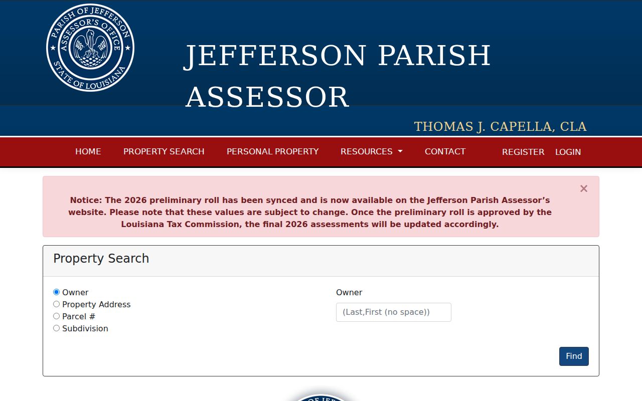
The visible modes reinforce why a Kenner street directory search should retain parcel, subdivision, block, and lot details instead of relying on the street text alone.
Kenner Mailing and Situs Addresses
An assessor card distinguishes the physical property from the mailing address used for tax notices. Records workers often call the physical location the situs address. A mailing address may belong to the same property, an owner's other home, a business office, or a chosen correspondence point. It does not prove that the owner lives on the Kenner parcel.
The card may also show a homestead indicator. That is an owner-use and tax clue, not a full household roll. Keep each field under its own label when building a by-address log. This small discipline prevents a mailing record from becoming an unsupported claim about current residence.
- Parcel
- A mapped unit of land identified for assessment and record matching.
- Situs address
- The physical location of the property, distinct from the tax mailing address.
- Plat
- A recorded drawing that lays out lots, blocks, streets, and other land features.
- Criss-cross directory
- A dated directory arranged by street and house number rather than only by name.
Map Kenner Streets in JeffMap
The Jefferson Parish Geoportal, called JeffMap, adds the spatial facts a parcel card cannot show. Use Identify on a target polygon, then switch on parcels, address points, buildings, subdivisions, street centerlines, and city boundaries. For an odd corner, canal, servitude, or common area, the Buffer Query can collect nearby features within a small radius. The viewer is useful, but it is not a survey and it does not establish occupancy.
Mark why each parcel counts as nearby: touching, across the street, behind a servitude, or within the same legal block. A Kenner street can cross a ZIP, ward, precinct, subdivision, or municipal line. Preserve all of those fields separately. The parcel is the bridge back to the Assessor and deed index.
Kenner Maps Fix a Parish Quirk
Jefferson Parish's planning and zoning map expressly excludes incorporated Kenner. A blank parish zoning result is therefore not proof that a Kenner address has no zoning record. Use the city's own street, subdivision, zoning, precinct, council-district, and special-purpose maps for the municipal layer, while JeffMap and the Assessor supply parcel context.
The Kenner City Maps collection is shown in the captured screen below. Its mix of maps helps distinguish a familiar neighborhood label from a legal subdivision name.
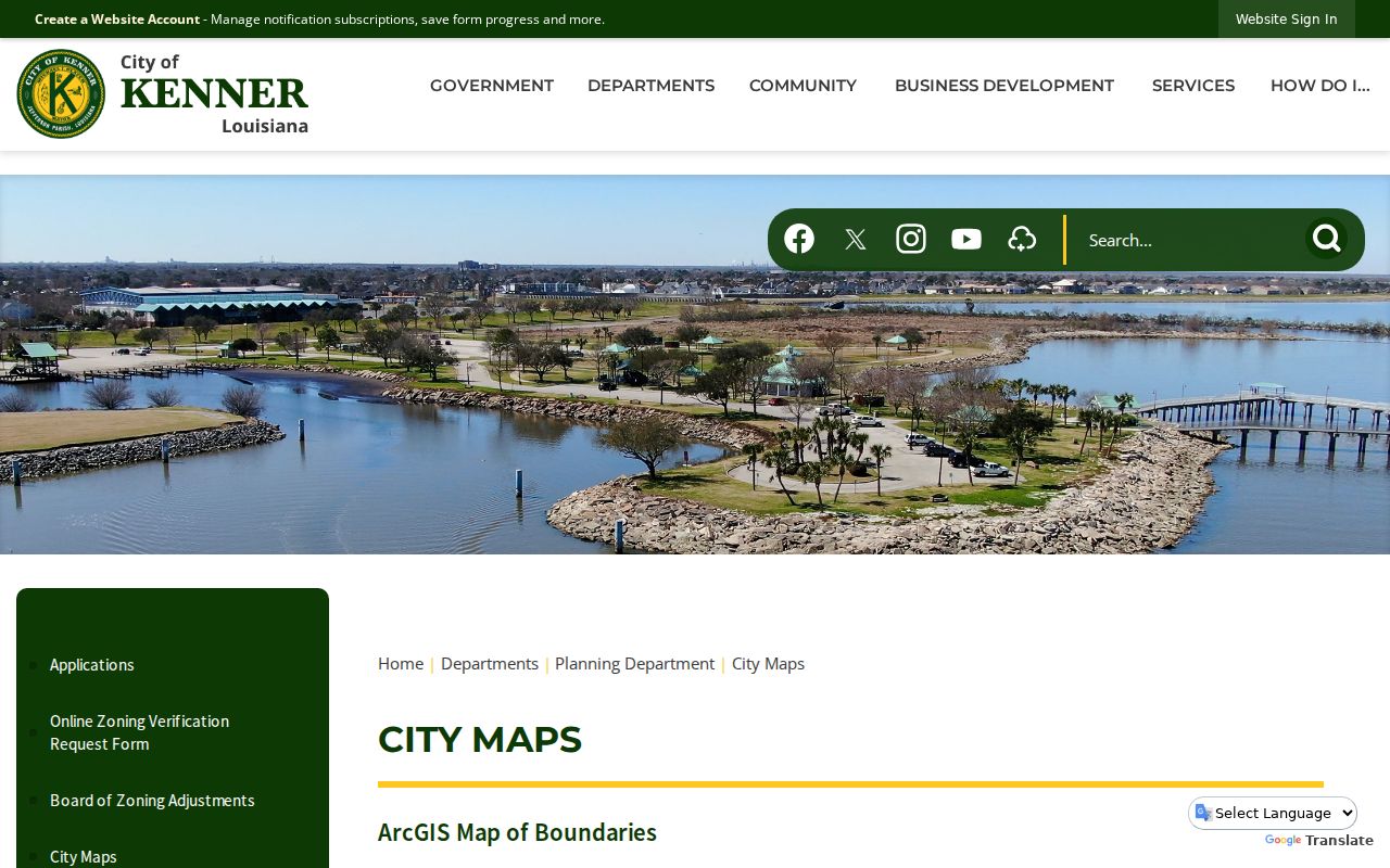
This local exception is a key Kenner street directory check. Keep the city layer and the Jefferson Parish parcel layer together rather than treating either as complete.
City map categories can also guide an offline request. Save the map title, revision date, street, subdivision, and council or precinct label, then ask the Kenner office for the permit, zoning, agenda, or code file tied to that exact place and period.
Kenner Street Directory Evidence
Each address-keyed source answers a different question. Current parcel tools identify land and tax fields. Deeds document named parties to an instrument. Voter records describe a public registration match subject to protected omissions. City files can identify a project or complaint category, and dated publications may connect a household or business with an earlier street form.
| Address source | Custodian | Street evidence | How to reach it |
|---|---|---|---|
| Assessment card | Jefferson Parish Assessor | Owner, physical and mailing addresses, legal description, deed lead | Free web search or assessor office |
| Parcel map | Jefferson Parish GIS | Parcels, address points, streets, buildings, subdivisions, city line | Free JeffMap viewer and service layers |
| Deed index | Jefferson Parish Clerk of Court | Instrument parties, date, type, number, description | Free eClerks index; JeffNet images; counter or written request |
| Voter record | Louisiana Secretary of State | Address, ZIP, precinct and district context where public | Voter Portal, registrar office, or purchased list |
| Permit or code file | Kenner Inspection and Code Enforcement | Work or case tied to a location; applicant may be named | Department records or city public-record request |
| Dated directory or map | Library and historical collections | Earlier name-address entries and street form | Library, archive, digitized collection, or reading room |
The sources overlap without becoming interchangeable. Record the access date and exact field label. A map point, tax owner, deed party, voter residence, permit applicant, and historical occupant should never be collapsed into one “resident” column.
Follow Kenner Deeds Along Streets
The free eClerks index gives the Kenner street directory a path from parcel owner to recorded instrument. It accepts a last name or entity, optional first name, match type, date range, and Land, Marriage, or Civil document set. Results show date, set, type, number, two indexed parties, document type, description, and parish. Once the Assessor supplies an owner, select Land and search a tight date span. “Contains” can catch variants that an exact match misses.
Use the instrument number to obtain the image through paid JeffNet or from the Jefferson Parish Clerk of Court. Electronic mortgage and conveyance indices are described from 1967 forward, while the clerk describes older index and image material back to 1825. In-person inspection is free during posted weekday hours. Copies can also be sought at the mortgage and conveyance counter in Gretna or through a specific written request.
Cost-saving tip. Search names and dates in free eClerks first, then pay for or request only the image tied to the right instrument number.
Kenner Address Files Beyond Parcels
Permits and code cases can add a dated event to an address history. Kenner Inspection and Code Enforcement keeps permit and inspection material, and a file may identify work, a location, and the submitting owner or contractor. That named applicant is not automatically an occupant. The city's complaint route likewise takes a location and requester details but is not a public address-to-person index.
If an online page does not expose the needed file, send a focused request through the Kenner City Attorney's public-record channel. Name the address, approximate dates, originating department, record category, and whether inspection or copies are requested. Current recovery work may also leave a trail: Kenner's 2025 update said permits remained required for Hurricane Francine damage even where fees were waived.
Read Old Kenner Street Names
Modern address text can fail in an older Kenner street directory. Search Williams Boulevard and its shortened form, West Esplanade Avenue and W Esplanade, numbered streets, subdivision names, and lot or block descriptions. For much earlier material, test Kennerville, Cannes Brulee, and the Oakland, Belle Grove, or Pasture plantation names. Keep the original spelling in notes and use a normalized form only as a second pass.
Kenner's growth supplies useful date windows. The Orleans and Kenner streetcar ran from 1914 to 1931. The 1926 and 1939 Sanborn sheets can compare older buildings and blocks with today's GIS. Airport development from 1940 to 1946, followed by suburban and I-10 growth, changed the address landscape. When the task becomes a full historical collection search, the Kenner city directories explain the dated shelf without turning a current street search into a genealogy catalog.
Check Kenner Voter Address Fields
The Louisiana Voter Portal's address route uses ZIP, address, apartment or lot, and city. Normalize the address first, then test direction and street-type variants if no match appears. Use Kenner in the city field when the municipal address is Kenner instead of assuming the ZIP settles the city. The name route adds first and last name, ZIP, and birth month and year for a lawful personal verification.
Louisiana law makes specified registration fields public while withholding sensitive identifiers and protected-address data. The Address Confidentiality Program can replace an actual address for qualifying survivors. A correct search can therefore return no public address. Precinct and ward fields add civic geography, but a shared precinct may cover many blocks and proves neither proximity nor a shared household.
Limits of Kenner Street Records
No official Kenner street directory is a complete current household list. The research found no public utility-customer list and no comprehensive city-published association roster. Assessor ownership may differ from occupancy. A permit filer may be a contractor. A voter record reflects registration at the access date and may omit a protected person. A deed proves that named parties executed or received an instrument, not that they shared a home.
Use narrow statements tied to the source: the assessor listed an owner, the GIS placed an address point, or a dated directory printed a name and address. For one named person's wider trail, shift to the Kenner resident lookup instead of exposing unrelated people along the street.
Lawful use. Use Kenner address records only for lawful personal research. Never use a street search to stalk, harass, intimidate, or harm anyone.