
Kenner Neighbors By Source
A block lookup works best when geography comes first. Jefferson Parish's map shows which polygons and address points surround the target. The Assessor then identifies the current assessed owner and mailing fields. Deeds can supply the older legal chain. Voter data adds dated civic information, while city agendas can name an association or public issue tied to the block. Each source stops short of a complete household list.
| Source | What It Shows About a Block | Access |
|---|---|---|
| JeffMap parcel layer | Parcel edges, lot or square, address points, and subdivisions | Free viewer; not a survey |
| GIS REST layers | Address, parcel, zoning, flood, restriction, and location fields | Free service schema |
| Assessor search | Owner, tax, legal, situs, and mailing fields | Free current search |
| Clerk deed index | Historical parcel parties and legal chain | Free index; paid image or counter |
| Kenner city maps | Subdivision, zoning, Rivertown, precinct, and local context | Official maps and PDFs |
| Voter address and precinct | Public registration and district context | State portal; protected omissions |
| Agenda packets | Civic groups, block events, zoning, and district matters | City archive |
| Sanborn sheets | Past buildings, streets, and blocks | Library of Congress maps |
The phrase “next door” must be tied to the map. One parcel can touch the target, another can face it across a right-of-way, and a third may sit behind a canal or servitude. Those are different relationships. An assessed owner is also not the same as an occupant, renter, voter, or household member.
A practical research log needs only a few columns: parcel key, address point, adjacency type, owner field, mailing field, source date, and notes. Keep private details out of the log when the public parcel label answers the question. If the lot is owned by an entity, search the deed or state business filing only to understand that legal role. Do not turn an agent's address into a claim about who lives on the block.
Identify Kenner Neighbor Parcels
Enter the target address in JeffMap and use Identify on its parcel. Save the parcel key, legal description, subdivision, lot or square, and visible address point. Then click each polygon that shares an edge. Check the lots across the street as a separate group. A corner lot can face two streets, while common land may belong to a civic body rather than a person.
Turn on City Boundaries, Street Centerlines, Subdivisions, Parcels, and Address Points. Kenner has an important map quirk: Jefferson Parish's planning and zoning map excludes incorporated Kenner. A blank parish planning result does not mean the address lacks zoning. Use the city map and Jefferson GIS parcel layers for the Kenner location.
Map tip. Record whether each parcel touches, faces, or sits behind the target. Do not label all nearby lots as adjacent.
Buffer Kenner Block Records
JeffMap's Buffer Query helps when neat parcel clicks do not describe the block. Set a small radius in feet or yards around a parcel, lot, or drawn shape. It can catch an irregular rear lot, corner parcel, canal edge, or shared tract. Keep the radius narrow. A wide circle drifts into whole-neighborhood work and weakens the link to the target address.
The buffer is a geographic selection, not proof that the people tied to those parcels know one another. Label public, school, church, park, cemetery, airport, and common parcels before searching for names. When a canal, levee, servitude, or right-of-way separates two lots, preserve that fact in the research notes.
Map Kenner Neighbors Carefully
Once the map group is set, move from geometry to official record fields. This process keeps Kenner neighbors tied to a specific parcel instead of a loose street-name match.
- Normalize the address, locate it in JeffMap, and identify the target parcel. Save the parcel and subdivision keys.
- Click touching parcels, then those across the street. Use a small buffer only for irregular geometry.
- Open each parcel in the Assessor. Keep situs address, mailing address, owner, and legal description as separate fields.
- Use the deed index when ownership history matters. A current card alone cannot establish who lived there in the past.
- Check voter and civic sources only after the geography is set. Note source dates and protected-record limits.
The Assessor homestead indicator can be an owner-use and tax clue, but it is not a full resident roll. Mailing and situs addresses may differ. For a longer run beyond the immediate block, use the Kenner street directory workflow.
Kenner Neighbors In Civic Records
Kenner agenda records identify real groups, but they do not publish a complete member directory. Driftwood Park Civic Association appears in a city packet about a 2025 parade gathering and block party near Madrid Avenue. Veterans Heights Subdivision Association appears in a 2023 neighborhood-meeting record. That file says a mailing list came from a notarized property-owner list built with Assessor and Planning records.
Driftwood Park
City agenda packets document the civic association and a block event. Use the packet for group and place context, not private membership.
Veterans Heights
An archived meeting record documents the subdivision association and its owner-list method. No open member roster was found.
Historic Rivertown
The 12-block district links the Design Commission, Redevelopment Association, property actions, and public city records.
The Kenner Agenda Center is the public starting point for these groups. Search the subdivision, street, event, and association name. A packet may show where a project occurred while withholding resident names.
No comprehensive, current city directory of neighborhood or HOA contacts was located. The fallback chain is the city agenda archive, subdivision and zoning maps, the Assessor, local library reference help, and the named group itself if an official contact is published. This gap matters. It prevents an old meeting packet from being presented as a live roster.
Historic Kenner Neighbor Layers
Current parcel lines tell only part of a block's story. The Jefferson Historical Society Virtual Archives include a 1927 School Census, court minutes, yearly reviews, and a 15-volume WPA Historical Records Survey. Kenner's 1926 and 1939 Sanborn sheets add past building and street context. Use the legal lot or block when an old street name no longer matches modern text.
Explore the Jefferson Historical Society Virtual Archives before comparing a past block.

The categories identify schools, groups, roads, and dated block activity, but each entry still needs a source date and geographic check.
Historic Rivertown needs special care because it is both a living district and a formal record layer. Its design district was designated in 1983, and the commission followed in 1984. Planning and design records can connect a property to a project or applicant, but they do not name every person who occupied the site. Pair them with a dated directory, deed, or news item when the goal is block history.
Kenner Neighbor Voter Geography
The Louisiana voter system offers name, parish, and address routes. Public list fields can include residence street, apartment, ZIP, ward, precinct, and district information. At block level, use them as dated civic geography. A shared ward or precinct can span many blocks and does not prove that two people share a home or know one another.
Louisiana law protects sensitive identifiers, specified ballot material, younger registrants, certain law-enforcement records, and Address Confidentiality Program data. The 2026 Jefferson Parish precinct changes also mean an older precinct source may not match the current map. Save the year with any Kenner neighbor comparison.
Note: A voter address result is a registration record on the search date, not a live occupancy check for the block.
Official Kenner Neighbor Sources
Official rolls show their custodian and record type. Commercial neighbor tools may blend names, old addresses, and purchased data while hiding the date or cause of a match. Use the category only as an unverified lead, then return to Kenner, Jefferson Parish, or Louisiana records.
| Source | Best Use | Limit |
|---|---|---|
| Official GIS and Assessor | Parcel geometry, owner, and legal fields | Owner does not equal occupant |
| Official voter and city records | Dated civic or association context | Protected omissions and no full household roll |
| Commercial compilation | Possible spelling or past-address lead | May be stale, merged, or unclear about sources |
Stop once the lawful personal question has been answered. Building a larger profile adds risk without making the block relationship more accurate.
For a present-day question, prefer the current map and card. For a former block, freeze every source to the same year as closely as possible. Street extensions, subdivisions, ownership changes, and new address points can otherwise make two accurate records look as though they describe the same place when they do not.
Privacy For Kenner Neighbors
Utility customer data and a full current HOA member roster were not found as public Kenner sources. Do not infer a person from a meter, delivery point, shared ZIP, or parcel owned by a school, church, park, cemetery, airport, or public body. Louisiana's Address Confidentiality Program can replace a qualifying survivor's actual address with a substitute in public-facing records.
Public safety lists have narrow meanings. An arrest is not a conviction, and a statutory registry is not a general block directory. The Louisiana State Police warns that registry data may not be current or complete and forbids harassment or intimidation.
Review the Louisiana State Police registry notice before any search.
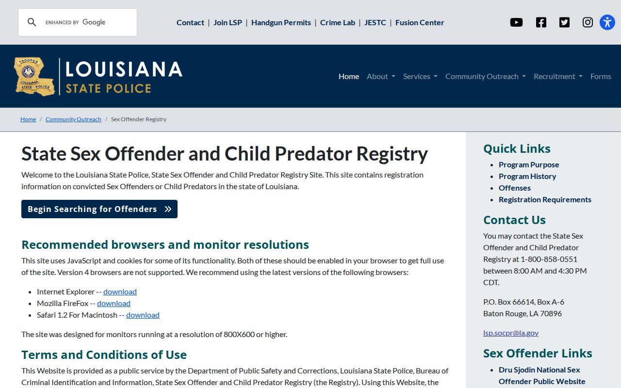
The acknowledgement warns that legal access does not permit threats, misuse, or a claim that every listed address is current.
Lawful use. Research Kenner neighbors for civic curiosity, reconnection, or personal safety. Never watch, threaten, harass, or harm another person.